
A wildfire burning seven miles north of Sedona in the Oak Creek Canyon area has closed Highway 89A in both directions and forced evacuations from the area.
The Pocket Fire was upgraded to 500 acres around 8:30 p.m. and was first reported around 5 p.m. on Friday. Located near the Coconino County-Yavapai County line north of Sedona and northwest of Indian Gardens, the fire is in the Red Rock-Secret Mountain Wilderness Area and west of Highway 89A. Smoke was quickly visible from multiple areas nearby as the fire is currently burning timber and brush.
Coconino County Evacuation Zones
gallery:
Pocket Fire Leads To Evacuations
12 hrs ago
Coconino County Sheriff’s Patrol Volunteer Stoney Miller talks with drivers Friday evening at a road closure on Highway 89a at Fort Tuthill. The Pocket fire burning north of Sedona led to the evacuation of Oak Creek Canyon and the closure of Highway 89a at both ends of the canyon. By 10 p.m. Friday night the fire had grown from 100 to 500 acres.
Pocket Fire Leads To Evacuations
12 hrs ago
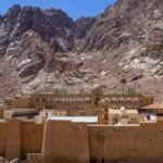
The Pocket Fire burning seven miles north of Sedona led to the evacuation of Oak Creek Canyon Friday night and the closure of Highway 89A at both ends.
Pocket Fire Leads To Evacuations
12 hrs ago
The Pocket Fire burning seven miles north of Sedona led to the evacuation of Oak Creek Canyon on Friday evening and the closure of Highway 89A at both ends.
About the Author
To get daily local headlines delivered to your inbox each morning, sign up for newsletter!